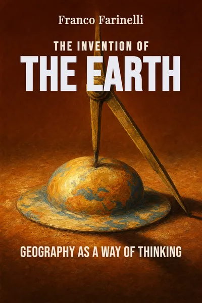
The Invention of the Earth
Geography as a way of thinking
Description
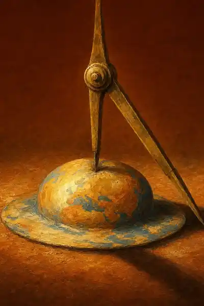
We tend to assume the order runs one way: there's the Earth, vast and bumpy and real, and then there's the map, a flattened little copy we keep in a glovebox or a phone. The territory comes first, the drawing after. In The Invention of the Earth, the Italian geographer Franco Farinelli spends a short, dense book arguing that this feels obvious precisely because it's backwards. The map, he says, didn't come after the Earth. In a sense the map is what made the Earth thinkable in the first place — a smooth, measurable, continuous surface that nobody has ever actually walked across.
Farinelli's claim is not a riddle for its own sake. He means something specific by "Earth," and it isn't the planet. The planet is irregular, broken, full of slopes and rivers and distances that change depending on how you cross them. The Earth — the idea of a uniform surface you can measure, divide, and compare, where a mile here equals a mile there — is a human invention, built by Greek geometers, carried by cartographers, and eventually mistaken for the ground under our feet. Geography, in his telling, was never just the description of places. It was a way of thinking that reorganized reality to match its own tools.
What makes the book unsettling is that it refuses to stay in the past. Once you've agreed that the map produces the Earth rather than the reverse, Farinelli walks you toward the present, where the globalized world runs almost entirely on representations — grids, coordinates, screens — that we treat as more real than the places they stand for. The quiet suggestion is that we've been living inside the map for a while now, and barely noticed the moment the copy took over.
The question we’re asking : If the map is supposed to copy the Earth, what happens when the copy turns out to have come first?What we’ll see : How a Greek geometric trick became the surface we think we live on — and why the drawing kept outrunning the ground.
Table of contents
01 Chapter 1 — The map came first
Farinelli starts with a distinction most of us never bother to make. There is the land — what he sometimes calls the territory — and there is the Earth, and these are not the same thing. The land is what you encounter when you move through it: uneven, resistant, stitched together from valleys and ridges and coastlines that no straight line respects. The Earth, by contrast, is the thing we picture when we close our eyes and imagine the planet from outside: smooth, round, continuous, a surface where every point relates to every other point through measurable distance. That second thing, he argues, is a fabrication. Nobody has ever experienced it. It exists first as a drawing.
The word geography says it plainly — earth-writing. And writing, for Farinelli, is the operative verb. To map a stretch of land is not to passively record it but to translate it into something the land is not: a flat, reduced, geometric sign that obeys rules the ground never agreed to. A good map makes a mountain range into a shaded patch and a three-day walk into two centimeters. In doing so it quietly asserts that space is uniform, that it can be scaled down evenly, that the distance between two cities is a single number rather than a question of weather, terrain, and who you are.

02 Chapter 2 — Thales draws the world flat
The decisive move, for Farinelli, happens with the early Greeks, and above all with Thales of Miletus in the sixth century BCE. Thales is usually remembered as the first philosopher, the man who said water was the principle of everything. Farinelli is more interested in a quieter achievement attributed to him: the application of geometry to the surface of the world. Geometry literally means earth-measurement, and the Greeks turned it from a practical trick — the Egyptians used it to re-divide fields after the Nile's floods — into a universal language that could be laid over anything.
Here is the sleight of hand that interests Farinelli. Geometry works on an ideal plane: flat, infinite, where parallel lines never meet and a triangle behaves the same everywhere. The actual Earth is a lumpy sphere where none of that holds. To make geometry apply to the world, you first have to pretend the world is flat and uniform — to treat the curved, irregular ground as if it were the geometer's clean sheet of paper. The map is the device that performs this pretense. It takes the resistant surface of the land and renders it as a plane, so that the tools of the plane can be used on it.
03 Chapter 3 — From the globe to the grid
If Thales supplies the gesture, the later history supplies the machinery that made it dominant. Farinelli follows the long consolidation through Ptolemy, whose second-century Geography proposed mapping the known world by fixing each place to a pair of coordinates — latitude and longitude — so that any location could be reduced to two numbers. The grid is the crucial invention here. It imposes a uniform net over the whole surface, declaring in advance that space is regular and that every point is equivalent to every other, differing only by position on the lattice.
The grid does something radical: it abolishes the particularity of places. On a gridded map, a city is not a city with its own history and character; it is an intersection of two lines. The grid treats Rome and an empty patch of ocean with perfect equality — both are just coordinates. This is the moment geography becomes a way of thinking that can be exported, standardized, and taught. You no longer need to have seen a place to locate it. You need only its numbers. Farinelli reads this as the deep logic that later governs everything from colonial land-division to the straight-ruled borders of modern states drawn across deserts no surveyor had crossed.
04 Chapter 4 — When the copy outlives the original
Step back, and Farinelli's real argument comes into focus: we no longer live on the Earth so much as inside the map of it. This isn't a metaphor he reaches for at the end — it's the consequence the whole book has been building. Once the grid became the measure of reality, modern life quietly reorganized itself around the representation rather than the territory. Property lines, time zones, national borders, GPS coordinates: these are map-things, geometric fictions, and yet they govern our movements more firmly than any mountain or river ever did. The copy has become the operating surface of daily life.
What globalization accelerates, in Farinelli's reading, is precisely this triumph of the map over the land. A world that can be instantly navigated, shipped across, and logged into is a world that has been thoroughly flattened into coordinates — a planet treated as the uniform, frictionless surface the geometers first drew. The experience of place, of distance that costs effort, of ground that resists, keeps receding behind the smooth abstraction. We book a flight by choosing two points on a grid and arrive having crossed, experientially, almost nothing.
05 Conclusion
We began with the assumption that the territory comes first and the map after. Farinelli's book spends its length dismantling that order, and by the end the reversal feels less like a provocation than a description of where we actually stand. The Earth we picture — round, smooth, measurable, the same everywhere — was never underfoot. It was drawn, first by Greek geometers who flattened the world to apply their geometry to it, then by the gridmakers who taught the land to fit their coordinates. What we call the planet is, in large part, the long shadow of that drawing.
Related books