
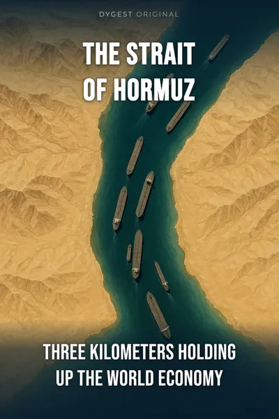
The Strait of Hormuz
Three kilometers holding up the world economy
Description
Between twenty and twenty-five percent of the world’s oil passes every day through a shipping lane about three kilometers wide. We fill up at the pump, heat our apartments, buy the plastic that wraps almost everything on the shelf — and a huge share of that invisible supply chain moves through a narrow channel between Iran and Oman, where 300-meter tankers pass each other single file every fifteen minutes.
We tend to talk about globalization as a giant web, an infinite network. The Strait of Hormuz is the opposite reminder: globalization hangs on a handful of tiny points on the map. An American admiral saw this coming at the end of the nineteenth century, long before a single barrel of crude moved through Hormuz. His idea — that sea power is decided at specific chokepoints, not across the open ocean — still explains almost everything that happens in that stretch of water today.
• The question we’re asking: how can three kilometers of sea between two countries hold a large slice of the world economy hostage?
• What we’ll see: what exactly passes through Hormuz, why geography leaves no alternative, what strategic theory calls a chokepoint, and why globalization rests on a small number of places just like it.
Table of contents
01A geography that leaves no alternative
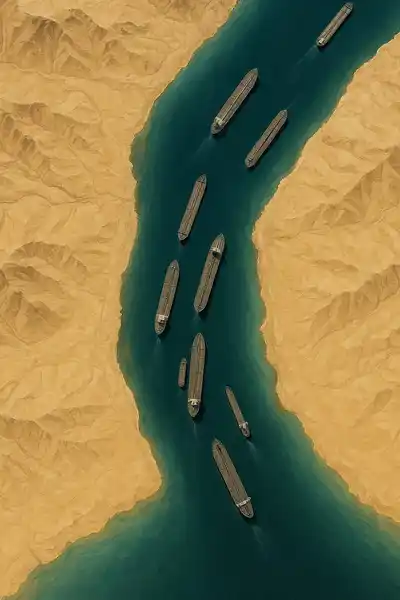
On the map, the Strait of Hormuz separates the Omani peninsula from Iran. Maximum width: thirty-three kilometers. On that raw width, the idea of a three-kilometer corridor might sound like an exaggeration — except that supertankers don’t use the full span. Shallow waters, reefs, sandbanks, and each country’s territorial zone shrink the actually navigable area to two corridors of about two kilometers each, separated by a buffer. One lane for ships coming into the Gulf, one for ships going out. Between them, a margin for error that’s almost nothing.
The tankers that move through Hormuz are among the largest ships ever built. VLCCs — Very Large Crude Carriers — run up to three hundred and thirty meters long. A ship doesn’t turn the way a car does: it needs several kilometers to change course, and in shallow water the maneuver is slow, precise, with no margin. The International Maritime Organization negotiated the separation of the corridors specifically to prevent collisions in that kind of constrained space.
02What passes through, and what would happen without it
Seventeen to twenty-one million barrels of crude and refined product leave the Persian Gulf every day through Hormuz. That’s twenty to twenty-five percent of world consumption, depending on the season and demand. Saudi Arabia, Iran, Iraq, the UAE, Kuwait — the five countries most dependent on the Strait for exports — don’t have a plan B that comes close.
Liquefied natural gas takes the same route. Qatar, long the world’s top LNG exporter, has only one maritime exit: Hormuz. Nearly a third of the LNG sailing the world’s oceans today passed through the Strait at some point on its trip. LNG tankers, recognizable by their white spherical domes, share the same corridor as the oil tankers, with no other option.
03What Mahan called a chokepoint
Alfred Thayer Mahan, an officer in the United States Navy, publishes a book in 1890 that changes strategic thinking: The Influence of Sea Power upon History. His central idea: the oceans are not a neutral, infinite space where power operates equally everywhere. The oceans are structured by forced passages — straits, canals, capes — where movement concentrates and where control of a single point gives disproportionate weight.
Mahan calls these points chokepoints. The word has since become a technical term in international relations. A chokepoint has three properties: it’s geographically narrow, it concentrates major flows, and it has no immediate substitute. All three criteria have to be met for the point to matter. A narrow passage with light traffic doesn’t count. A huge flow with several alternatives redistributes cheaply.
04A globalization of nodes, not networks
Hormuz isn’t alone. The material side of globalization rests on a handful of chokepoints that can be listed quickly, but that describe the architecture of world trade better than any atlas.
The Strait of Malacca, between the Malay peninsula and Sumatra, carries about a quarter of all maritime trade — more than a hundred thousand ships a year. It’s the main route between the Middle East and East Asia. The Strait of Bab-el-Mandeb, at the entrance to the Red Sea, controls access to the Suez Canal, and therefore the whole route from Asia to Europe. The Panama Canal, forty percent of Americas-bound maritime traffic. The Bosphorus, nearly all the Russian and Ukrainian grain leaving for the Mediterranean.
05Conclusion
Three kilometers of navigable channel between Iran and Oman. Twenty to twenty-five percent of the world’s oil. A third of the world’s seaborne LNG. A handful of countries whose wealth depends on it entirely, and a large share of the industrial economy of the world that depends on it partly.
Hormuz is the most visible case of a more general rule that Mahan spelled out more than a century ago: globalization, if you look at the map closely enough, rests on about a dozen critical points. We talk a lot about the web that ties everything together — we rarely talk about the nodes without which the web falls apart.